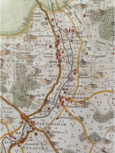
Hasted’s Map of 1789 shows some of the notable buildings in the parish
Hawley has Hawley House (now referred to as Hawley Manor) and the Mill
Sutton Place is shown with the Parsonage (later know as the Rectory, demolished in the 1930s)
The Vicarage and St John’s are marked on the map.
The roads marked on the map are not always the same as today and it is interesting to see where there are notable differences.